



Zoning, access, buildable ground, utilities, and legal restrictions can matter more than the number of acres on the listing.
For most buyers, vacant land for sale in Bayfield County, WI can look like an irresistible canvas for a home, retreat, or a hunting property. But acreage alone tells you surprisingly little about what you can actually do with it.
Local zoning regulations, soil profiles, seasonal road access, wetlands, shoreland setbacks, and utility cost extensions are just some of the factors that determine whether you can actually build your envisioned home, cabin or private getaway. Conducting thorough, hyper-local due diligence when choosing Bayfield County, WI real estate ensures your investment is aligned with your long-term plans in Northern Wisconsin.
Table of Contents:
- What do you want to do with the land?
- What does the zoning allow?
- How much of the property is actually buildable?
- Can you legally and practically reach the property?
- How much does it cost to bring the land to life?
- Read the title documents, not just the listing
- Evaluate the land for what it offers beyond a homesite
- What surrounds the parcel?
- FAQs about land for sale in Bayfield County, WI
- Make a more informed land purchase in Bayfield County with Broad Street Brokers
What do you want to do with the land?
Before comparing parcels, clarify the exact job the land needs to do for you. A year-round residence, seasonal retreat, hunting tract, managed timber parcel, or long-term investment each requires a completely different set of physical features, access needs, and municipal approvals.
Different corners of Bayfield County cater to distinct land uses:
- Lakeshore and bay communities (Bayfield, Washburn, Cornucopia, Herbster, Port Wing): These coastal areas span a range of Lake Superior properties, offering high-demand sites for primary lake homes, seasonal cabins, and refined retreats.
- Interior lakes and timber hubs (Iron River, Barnes, Cable): Ideal if you are looking for wooded acreage, private hunting tracts, trails near the Chequamegon-Nicolet National Forest, or inland lake access.
Defining your long-term plan early keeps you focused on usable features rather than unneeded acreage – a core step when evaluating Bayfield County real estate options. Consider these specific requirements:
- Year-round primary home: Prioritize proven buildable ground, reliable winter road maintenance, private septic suitability, and direct utility access. Account for future accessory structures like garages or pole barns during initial site planning.
- Seasonal cabin or retreat: Focus on seasonal road access, proximity to trail systems or water, shoreland restrictions, and simple winterization options.
- Hunting or recreational tract: Dense forest cover, wildlife habitat, natural water sources, interior trail networks, and proximity to public forest lands may take precedence over residential buildability.
- Timber property: Evaluate tree species, stand age, historical management, timber value, and eligibility for Wisconsin’s Managed Forest Law (MFL) program.
- Agricultural use or homestead: Inspect soil drainage, open acreage, topography, and equipment access routes.
- Long-term land investment: Evaluate underlying zoning, local land-use plans, property taxes, and long-term resale potential independent of immediate building plans.
⛰️ Considering buying rural land in Northern Wisconsin?
Check out our previous post to explore the region’s distinct townships, Lake Superior shorelines, and Northwoods landscapes.
What does the zoning allow?
A property listing might market a parcel as an ideal homesite, cabin property, or recreational retreat. But those descriptions are sales copy, not a legal guarantee.
When evaluating land for sale in Bayfield County, WI, remember that properties sit outside municipal sewer lines and fall under layered county and township ordinances. Always verify the official zoning classification through the Bayfield County Planning and Zoning Department and local township offices to confirm if your project is permitted by right, or requires a conditional use permit.
Pay close attention to these regulatory factors:
- Minimum lot sizes and setbacks: County and township rules mandate minimum road, side-yard, and backyard setbacks that directly limit where a structure can sit.
- Permitted land uses: Confirm whether residential, short-term rental, agricultural, commercial, or forestry operations are allowed.
- Accessory building rules: Review local limits on square footage, wall height, and quantity for detached garages, pole barns, and guest cabins.
- Shoreland overlay districts: Land within 1,000 feet of a navigable lake or 300 feet of a river faces strict limits on tree clearing, imperious surface ratios, and water setbacks.
Verifying land-use rules directly with local zoning officials before submitting an offer saves significant time and prevents costly redesigns.
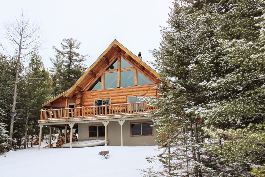
Several factors can easily shrink the total buildable area in a parcel of land.
How much of the property is actually buildable?
A parcel that looks vast on a plat map can quickly shrink when you walk the ground. Soil composition, standing water, steep grades, and rock outcrops frequently restrict usable ground in Northern Wisconsin.
When reviewing land for sale in Bayfield County, WI, make sure to evaluate the following physical factors.
Investigate soils and septic suitability
Any home built outside municipal sewer service requires a private onsite wastewater treatment system (POWTS). Because local soils range from non-porous red clay to fast-draining sand, septic requirements vary drastically across the county.
A licensed soil tester must conduct a soil evaluation to check limiting conditions like seasonal high water tables or shallow bedrock. Soil conditions determine whether a site accepts a conventional gravity drainfield or requires an engineered mound system or holding tank.
Always plan the house site, well location, driveway, and primary and replacement septic drainfields together to ensure the parcel offers enough usable space.
Check wetlands and water features
Lake Superior coastal streams, inland kettle lakes, and seasonal low spots make Bayfield County beautiful. But they also restrict construction.
Consult the Wisconsin Wetland Inventory and FEMA floodplain maps to identify protected ground. Properties in Cornucopia, Herbster, and Port Wing require careful checking. That’s because coastal streams, clay bluffs, and wetland pockets frequently alter where driveways and buildings can be set.
Walk the terrain
Physical topography dictates construction feasibility. Keep an eye out for:
- Slopes and ravines: Steep grades demand specialized foundation engineering and potential increase in excavation costs.
- Bedrock and surface drainage: Shallow rock ledges complicate utility trenching, well drilling, and foundation digging.
- Driveway corridors: Long or steep approaches require extensive clearing, cut-and-fill grading, and heavy culverts to handle spring runoff.
A smaller 5-acre parcel with high, dry ground and clear road access often proves to be far more useful than a 40-acre tract made up mostly of forested wetland.
💡 New to Bayfield County?
Get to know this vibrant Lake Superior community, from its historic orchards and working harbor to its downtown shops.
Can you legally and practically reach the property?
Seclusion is a major reason buyers look at lots for sale in Bayfield County. But physical and legal access must be verified before closing.
Determine whether access relies on a dedicated public road, private road, shared driveway, or recorded ingress/egress easement across neighboring property. These critical questions should also be a part of your due diligence:
- Who owns the access road and holds legal responsibility for maintenance?
- Is the road plowed by the county or township during winter months?
- How are maintenance costs, grading, gravel, replacement, and snowplowing split among neighbors?
- Can heavy construction equipment, delivery trucks, and emergency vehicles navigate the driveway year-round?
- Are there seasonal weight limits or spring thaw restrictions on access roads?
- Does the recorded easement explicitly cover power and communication utility lines, or strictly physical travel?
Access requirements also vary by location. Parcels near Bayfield and Washburn sit closer to established county roads, whereas acreage around Iron River or Cable may rely on private forest roads. A trail that works for an ATV in July can easily become impassable for a passenger vehicle in February without ongoing private snowploying.
If you are evaluating lakefront or stream-adjacent land, inspect physical access down to the water separately. Elevated bluffs require well-engineered stairways to reach the beach safely.
How much does it cost to bring the land to life?
The purchase price of raw land is only a portion of your total investment. Developing vacant acreage into a functional homesite also includes budgeting for site preparation, driveways, utilities, and private infrastructure.
As you evaluate land for sale in Bayfield County, WI, check whether utility service lines are nearby or if the parcel has ever had connections. Gather realistic estimates for these core development items:
- Electrical service: Contact local electrical cooperatives (such as Bayfield Electric Cooperative or Xcel Energy) to calculate line-extension fees per foot from the nearest transformer.
- Private well: Consult local well drillers regarding typical water depths, rock formations, and average drilling costs in the immediate township.
- Septic installation: Factor in certified soil testing, system design, county permitting, and construction expenses for standard or engineered mound systems.
- Heating systems: Check if natural gas is available for you, or if you need to budget for propane tanks, outdoor wood boilers, or heat pumps.
- Internet access: Confirm whether fiber-optic internet serves the road or if the location requires satellite setups.
- Professional services: Budget for boundary surveys, soil evaluations, engineering, and driveway permits.
Distance increases costs quickly. Building a home several hundred feet off the road significantly increases driveway graveling, trenching, and utility line extension expenses. Securing contractor estimates before writing an offer gives you a realistic view of overall project costs.
🤔 Thinking about Washburn?
Take a closer look at this lakeside community to discover its quiet beaches, active waterfront, and year-round neighborhood feel.
Read the title documents, not just the listing

Before comparing acreage or asking prices, define what you want the property to accomplish.
A real estate map shows exactly where a parcel sits. Title documents, however, reveal the exact legal rights, restrictions, and encumbrances attached to the land. So, it makes sense to review the preliminary title commitment and underlying recorded documents for restrictions that could alter your plans.
Look closely at the following:
- Utility easements: These are corridors often reserved for power or telephone lines. Permanent structures cannot be built on these areas.
- Access easements: Legal rights may be held by adjacent landowners to drive across your parcel.
- Conservation easements: Sometimes, vacant land also comes with permanent restrictions that prohibit tree clearing, subdivision, or building on specific portions of the acreage.
- Deed restrictions and covenants: Look for private covenants that regulate minimum square footage, outbuilding materials, campers, livestock, or timber harvesting.
- Severed rights: Title records can show whether previous owners retained timber, mineral, or water rights.
Shared driveways require clear and written maintenance agreements that specify how grading, repair, and snow removal expenses are shared.
Never rely on old wire fences, tree lines, or existing clearing edges to mark property boundaries. Hiring a registered land surveyor to conduct a boundary survey confirms precise property corners and reveals unrecorded encroachments before closing. An unexpected easement or restrictive covenant can drastically change what you can build on lots for sale in Bayfield County.
Evaluate the land for what it offers beyond a homesite
Not every valuable tract of land needs a foundation poured on it straight away. For many buyers, the true appeal of Bayfield County lots for sale lies in timber management, private hunting, outdoor recreation, or long-term conservation.
Evaluating a parcel’s natural characteristics helps you understand its immediate utility and long-term value before you make an offer.
Forest resources and timber potential
If a property holds significant wooded acreage, take time to inventory the standing trees.
- Tree species diversity: A healthy mix of red oak, hard maple, white pine, and balsam fir indicates a resilient ecosystem and future harvest value.
- Stand maturity and records: Check the age of the timber and request past logging records to understand past forest management.
- Managed Forest Law (MFL): Verify if the parcel is enrolled in Wisconsin’s MFL program, which significantly reduces property taxes in exchange for a sustainable forestry plan.
Wildlife habitat and recreational appeal
For hunters and outdoor enthusiasts, land quality extends beyond surveyed lines.
- Habitat features: Look for natural water sources, brushy transition zones, and mature oak ridges that feed white-tailed deer, ruffed grouse, and black bear.
- Public land borders: Parcels bordering the Chequamegon-Nicolet National Forest or county forest land effectively expand your hunting and hiking footprint by thousands of acres.
Trails, topography, and seasonal access
How you physically move across the terrain dictates day-to-day usability.
- Internal access: Existing logging roads and skid trails offer ready-made routes for hiking, snowshoeing, or ATVs.
- Terrain considerations: Gentle rolling ground is easy to navigate, while steep ravines or low-lying swales may require culverts or bridge work.
- Trail connections: Confirm how easily you can access local Northwoods snowmobile and ATV trail networks directly from the property line.
Agricultural capabilities and natural privacy
Even small-scale farming or food plots require specific physical conditions.
- Ground and soil quality: Evaluate soil drainage, sunlight exposure, productivity ratings, and clearance for tractor equipment.
- Topographic privacy: Elevated ridges, thick pine buffers, and natural clearings allow you to establish a completely private setting without needing massive acreage.
The surrounding community puts these natural features into perspective. Shoreline towns like Bayfield, Washburn, Cornucopia, Herbster, and Port Wing emphasize Lake Superior access. Meanwhile, interior hubs like Iron River cater to buyers drawn to dense forest tracts, inland fishing lakes, and expansive trail systems.
What surrounds the parcel?

Before you make an offer, don’t forget to take a look at what surrounds the land you want to purchase.
A parcel might meet every requirement on your list, but the surrounding land also directly affects your enjoyment and the land’s long-term value. When purchasing land for sale in Bayfield County, WI, take your time to inspect the broader neighborhood and surrounding acreage:
- Active neighboring operations: Inspect adjacent parcels for active farms, gravel pits, commercial timber operations, public hunting grounds, or high-traffic roadways. Noise, dust, truck traffic, or seasonal land management could impact your intended use.
- Local planning and development trends: What’s in the pipeline for the area? Review recent building permits, proposed land subdivisions, township zoning updates, and county land-use plans to see how the surrounding area is projected to evolve over the next decade.
- Recreational trail corridors: Proximity to public snowmobile or ATV trails offers ultimate convenience for riders, but you might find your privacy compromised especially during peak tourist season.
- Public land dynamics: Bordering county or national forest land provides thousands of acres of open space. However, you might find seasonal hunters and outdoor enthusiasts near your property boundaries.
FAQs about land for sale in Bayfield County, WI
How much of a large parcel is usually buildable?
Usable area depends on county zoning setbacks, soil percolation ratings, mapped wetlands, severe topography, and recorded easements rather than total acreage alone.
Do I need a soil test before buying vacant land in Wisconsin?
Yes. Conducting a soil evaluation before purchasing verifies whether the land can support a private septic system. It also dictates the type of system required.
Is a private road a problem when buying land?
Not if legal access is clear. Confirm recorded ingress/egress easements, review written maintenance agreements, and verify winter snowplowing access for emergency and construction vehicles.
What should I investigate before buying land near a lake?
Review Bayfield County shoreland zoning, building setbacks, wetland maps, floodplain levels, bluff stability, and restrictions on clearing shoreland vegetation.
Should I get a survey when buying acreage?
Absolutely. A boundary survey accurately locates property corners, verifies total acreage, identifies line encroachments, and clarifies easement boundaries prior to closing.
Make a more informed land purchase in Bayfield County with Broad Street Brokers
Finding the right parcel takes more than comparing acreage and asking prices. Broad Street Brokers brings more than 40 years of combined experience and extensive Northwoods knowledge to help you evaluate access, buildability, and long-term potential.
If you’re considering land for sale in Bayfield County, WI, call our office at 715.779.3220 or send us a message to get your free real estate consultation.